Current View
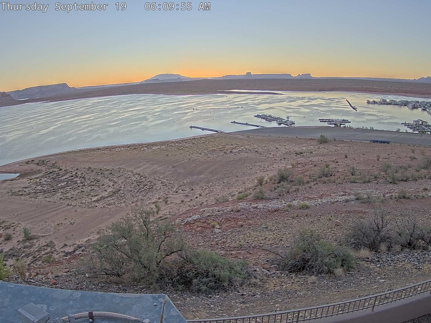
Wahweap Main Launch Ramp
A view over Wahweap Launch Ramp on Lake Powell in northern Arizona. This launch ramp is open for launching vessels when Lake Powell's elevation is above 3550'. Check the link below to see up to date information about the lake. When the launch ramp is open, use it to see how busy boat traffic is. When it is closed, you may park on the sides of the ramp for paddlecraft or beach use. Also seen in the shot are Government Docks - used by all the agencies who have jurisdiction at Lake Powell (federal, state, county, etc.), and the pumpout you use to empty out your vessel of blackwater after your trip. Across the lake you can see Navajo Mountain, Tower Butte, and other rock features. The image will update every 10 minutes.
Lake Powell was created in 1963 with the creation of the Glen Canyon Dam, and it took 17 years 1980 to fill. In 1869 Civil war veteran Major John Wesley Powell left Green River WY down the Green and Colorado Rivers to map the area. For more about the Parks rich history visit This Link.
The water level changes throughout the year and years. This link provides Water Level Data for Lake Powell.
Ambassador Guides and Captain Bill offers Guided Fishing Trips and produces a free Fishing Report Click Here.